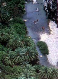
- Hania Rethimno, Iraklio, Agios Nikolaos, Sitia, lerapetra - each of these cities has a district personality that attracts many of the visitors to the island.
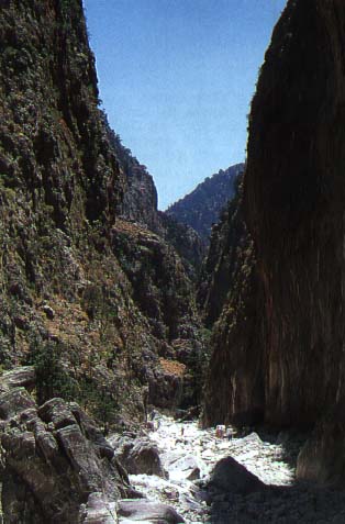
- The Samaria Gorge (B3-C3). 43 km. from the city of Hania, this is the longest gorge in Europe, measuring some 18 kilometres and renowned for its awesome beauty. At some points the passage is just 3 metres wide and at times the steep sides rise to a height of 600 metres. The gorge is cut by a stream which flows between the highest peak of the White Mountains and Mt. Volikas. Hiking down the gorge is permitted from May to the end of October depending on the weather. At the entrance to the gorge, at Xiloskalo there is a tourist pavillion with a view of majestic Mt. Gyrilo (alt. 2.083 m.).
- On leaving the gorge one encounters the village of Agia Roumeli (C3), where one can take a launch to Hora Sfakion and catch a bus back to Hania. The road from Hania to the entrance of the gorge traverses picturesque lowland and mountain villages. At the village of Omalos and the Omalos mountaln range one will find rooms for rent and a number of tavernas.
- Hora Sfakion (C3), 74 km. south of Hania, an unusual village built in a rocky, barren area, difficult to reach whether by sea or overland. To get there one crosses the Askyphos mountains and the Nimbros gorge.
- Gavdos (C3). An islet 24 nautical miles south of Sfakia (Hora
Sfakion). There are scheduled boats from Sfakia to this virgin
isle with its spotless beaches and its cedar trees all year long
(weather permitting). The island boasts some tavernas and a few
rooms to rent.

- The Therisso Gorge (B3). An impressive gorge, 6 km. long running between Hania and the village of Therisso at the foothills of the White Mountains, 16 km. south of Hania.
- Lake Kournas (B4). 48 km. east of Hania. A picturesque lake the only one on the island. The mountains surrounding it are reflected in its calm waters. There are tavernas in the area for a bite to eat.
- Argiroupoli (C4), 27 km. southwest of Rethimno. A village nested among greenery, built on a knoll not far away from springs that feed some enormous cisterns. Lower down the springs push watermills that make small cataracts in which the fluffy Greek flokates (rugs) are washed.
- Spili (C5), 28 km. southeast of Rethimno. A wooded village with stone houses and cobbled lanes. In its small, plane-tree shaded square there are 25 water spouts, sculpted in the shape of lion's heads, whose water comes directly from Psiloritis.
- Anogia (C6). A mountain village, 53 km. southeast of Rethimno, famous for its woven cloth.
- Fodele (B7), 29 km. west of Iraklio, the birthplace of the
famous painter El Greco (Domenicos Theotokopoulos) in 1545. A
picturesque village hidden in a verdant valley studded with
orange groves and plane trees.

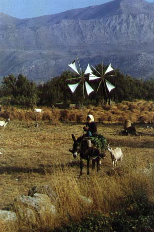
- The Lassithi Plateau (C9). 22 km. east of Iraklio the road passes through the wooded villages of the plateau (alt. 900 m., area about 25.000 sq. m.) punctuated by some 7000 colourful windmills that water the market gardens and apple and pear orchards in this lush region.
- Hrissi (D10). An islet lying exactly opposite lerapetra 9 n. mi. away, reachable by small excursion boats. It too possesses lovely beaches and cedar trees.
